You are currently viewing Photogrammetry Documentation Project
DCIM100MEDIADJI_0182.JPG

Photogrammetry Documentation Project

Ongoing project 2022

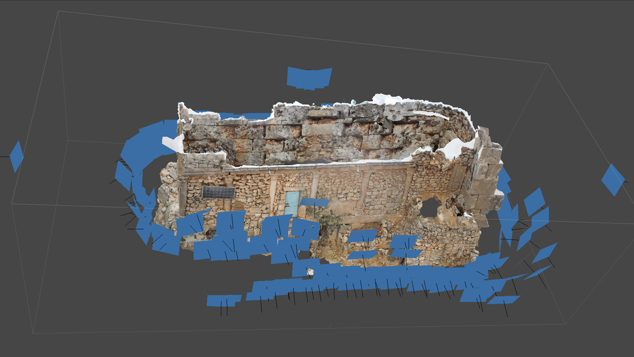
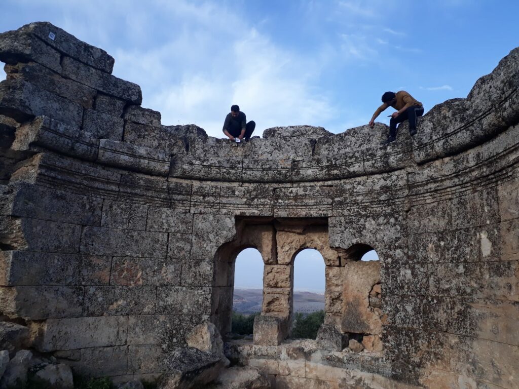
The project aims to create 3D digital models based on Photogrammetry scans, using high-resolution cameras and drones. Photographic documentation (including video) will be used to generate 3D models and focus on the location of the damage to document it accurately. 

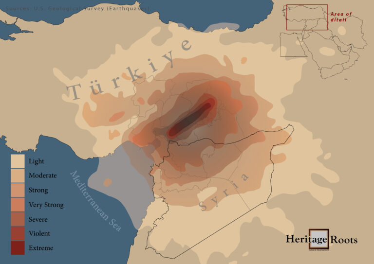
The project will cover the historical sites and monuments in north Syria including the world heritage sites (registered at UNESCO 2011) like Al-Bara, Sarjala, Al-Ruwaiha, and  Jaradah Parks, in addition to Shansharah, Al-Rabeeh, and historical buildings in Al-Ma’ara (Khan Murad Pasha – Khan Asaad Pasha).


The work includes topography mapping of the damaged parts using on-paper and AutoCAD files. Mapping the areas of damage will assist in developing appropriate solutions to deal with the damage, preparing emergency assessment studies, and proposing suitable protection/stabilization projects for that stage.

The Project will ensure :

– Train local Syrian archaeologists to document archaeological sites and monuments, and how to use 3D cameras and drones

– Establish a database archive to store and manage the 3D imagery collected in that project so that it may be continuously updated.

– Preparing emergency studies for the affected areas and the necessary protection/stabilization projects.


The project activities are maintained by The Syrian Heritage Protection Center (based inside Syria) in cooperation with TDA-HPI and Heritage Roots.


Leave a Reply